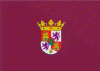
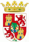
Puerto Real (Puerto Real)
 |
 |
The town is located on the northern shore of the inner lobe of the Bay of Cádiz, on the site of the ancient Roman settlement of Portus Gaditanus. An ancient trading post, it is probably the oldest settlement on the Bay of Cádiz. It owes its current name to the fact that it was rebuilt in 1488 by Ferdinand II of Aragon and Isabella I of Castile. Puerto Real boasts public squares and broad streets; it also has a town-hall building and a 16th-century church, which was constructed in several styles (Gothic, Renaissance, Baroque).
The town of Puerto Real has two separate zones with two separate characters, a maritime zone and a hinterland zone. Central Puerto Real lies entirely within the maritime zone, facing, as it does, the Bay of Cadiz and the Atlantic Ocean beyond. The inland zone, the so-called hinterland, is far larger in area but far less populated.
Puerto Real borders the towns and cities of San Fernando to the southwest, Chiclana de la Frontera to the south, Medina Sidonia to the southeast, Jerez de la Frontera to the north and northeast, and El Puerto de Santa Maria to the northwest.
A good portion of the periphery of Puerto Real lies within the Bay of Cádiz Natural Reserve, an area known for its salt marshes; the reeds of the marshes are the raw material for weaving mats that form the walls of cages in fish-farming enterprises (pisciculture). These wetlands, composed of lagoons as well as salt marshes, welcome, in the spring and autumn, huge flocks of migratory birds en route to their new seasonal homes. Also, on the outskirts of Puerto Real, there are several notable pine forests, among them, Las Canteras (the Forest of Quarries) and La Algaida (Mare's Meadow Forest). Because of its forests and estuarine marshes, Puerto Real is sometimes called the "green lung" of the Bay of Cádiz.
The San Pedro river, an arm of the Guadalete river, flows along the northwestern edge of the town, separating Puerto Real from neighboring El Puerto de Santa Maria. Puerto Real is united to Cádiz by the José León de Carranza Bridge, named for a former mayor of Cádiz. As of 2007, a second bridge was planned.
Other aspects of Puerto Real's geography are the many kilometers of gorges, ravines, and artificially created footpaths that traverse the municipality. Among them is a long green corridor, constituting one end of the Two Bays Trail that unites the two large bays of the province of Cádiz, the Bay of Cádiz and the Bay of Algeciras.
There are also two concentrations of population within the municipal limits of Puerto Real that are not contiguous with the central part of the city; they are called the District of Jarana and the District of the San Pedro (river).
Map - Puerto Real (Puerto Real)
Map


Country - Spain
 |
 |
| Flag of Spain | |
Anatomically modern humans first arrived in the Iberian Peninsula around 42,000 years ago. The ancient Iberian and Celtic tribes, along with other pre-Roman peoples, dwelled the territory maintaining contacts with foreign Mediterranean cultures. The Roman conquest and colonization of the peninsula (Hispania) ensued, bringing the Romanization of the population. Receding of Western Roman imperial authority ushered in the migration of different non-Roman peoples from Central and Northern Europe with the Visigoths as the dominant power in the peninsula by the fifth century. In the early eighth century, most of the peninsula was conquered by the Umayyad Caliphate, and during early Islamic rule, Al-Andalus became a dominant peninsular power centered in Córdoba. Several Christian kingdoms emerged in Northern Iberia, chief among them León, Castile, Aragon, Portugal, and Navarre made an intermittent southward military expansion, known as Reconquista, repelling the Islamic rule in Iberia, which culminated with the Christian seizure of the Emirate of Granada in 1492. Jews and Muslims were forced to choose between conversion to Catholicism or expulsion, and eventually the converts were expelled through different royal decrees.
Currency / Language
| ISO | Currency | Symbol | Significant figures |
|---|---|---|---|
| EUR | Euro | € | 2 |
| ISO | Language |
|---|---|
| EU | Basque language |
| CA | Catalan language |
| GL | Galician language |
| OC | Occitan language |
| ES | Spanish language |
